


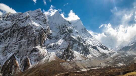
Laya Ghasa Trek- 18 Days
This trek, also known as the Jumolhari Trek, offers a diverse and intimate wilderness experience. It takes you through remote farmland, blue pine forests, alpine pastures, and offers stunning mountain views.
Bhutan
18 Days
Challenging
5,000 m / 16,400 ft
Mar-May, Sep-Nov
Hotel & Tented Camp
Included
Paro
Trip Highlights
- Explore the city and sights around Paro
- Relax at the Gasa Hot Springs
- Enjoy sightseeing in Thimphu
- Visit Laya, the second-highest settlement in Bhutan
- Cross the Shinchela Pass at an elevation of 5,000 m
Trip Overview
The Laya Ghasa trek begins from Paro and heads northwest, offering diverse trekking conditions, from scenic farmlands and subtropical forests to alpine pastures and high mountain passes. The trail passes through dense forests of rhododendron, willow, oak, blue pine, golden birch, and juniper.
This trek takes you through the remote and culturally rich villages of Chebisa and Laya, and along several nomadic campsites. Along the way, you may spot wildlife such as Taking and Blue Sheep, and even the occasional snow leopard. Enjoy a relaxing time at the hot springs, this trek is truly a memorable experience!
Outline Itinerary
- Day 1: Arrival at Paro Airport (2,280m)
- Day 2: Sightseeing around Paro
- Day 3: Drive from Paro to Shana (2,890m / 9,480 ft) - Distance: 15 km/ 9.3 miles, 5 hrs
- Day 4: Trek to Thangthangka (3,575 m): Approx. 22 km, 7 hrs
- Day 5: Trek to Jangothang - Chomolhari Base Camp (4,044 m): Approx. 17 km, 5 hrs
- Day 6: Acclimatization Day at Jangothang- Chomolhari Base Camp (4,044 m)
- Day 7: Trek to Lingshi (4,010 m): 21 km, 7 hrs
- Day 8: Trek to Chebisa: Approx. 16 km, 4 hrs
- Day 9: Trek to Shakya Pasang (4,000 m) via Gogu La Pass (4,440 m): Approx. 14 km, 5 hrs
- Day 10: Trek to Robluthang (4,160 m): Approx. 16 km, 8 hrs
- Day 11: Trek to Limithang (4,160 m): Approx. 14 km, 7 hrs
- Day 12: Trek to Laya (3,800 m): Approx. 9 km, 4 hrs
- Day 13: Rest Day in Laya
- Day 14: Trek to Koina (3,240 m): Approx. 16 km, 6 hrs
- Day 15: Trek to Gasa Hot Springs (2,220 m): Approx. 12 km, 6 hrs
- Day 16: Trek to Damji Village and Drive to Punakha: Approx. 14 km, 5 hrs
- Day 17: Drive from Punakha to Thimphu, then to Paro in the Evening
- Day 18: Transfer to the international airport for your final departure
Detailed Itinerary
Day 1: Arrival at Paro Airport (2,280m)
You can fly to Paro from cities like Bangkok, New Delhi, Kathmandu, and Dhaka. We suggest choosing Bangkok as your departure point since Druk Air operates daily flights between Bangkok and Paro, while flights from other locations are less frequent.
Upon your arrival in Paro, our airport representative will greet you and escort you to your hotel in a private tourist vehicle. After lunch, you’ll visit the Paro Dzong and the National Museum. In the evening, enjoy a stroll through Paro’s main market area
Max Altitude
: Paro Airport (2,280 m)
Meals
: Lunch, Dinner
Overnight
: Paro
Accomodation
: Hotel
Day 2: Sightseeing around Paro
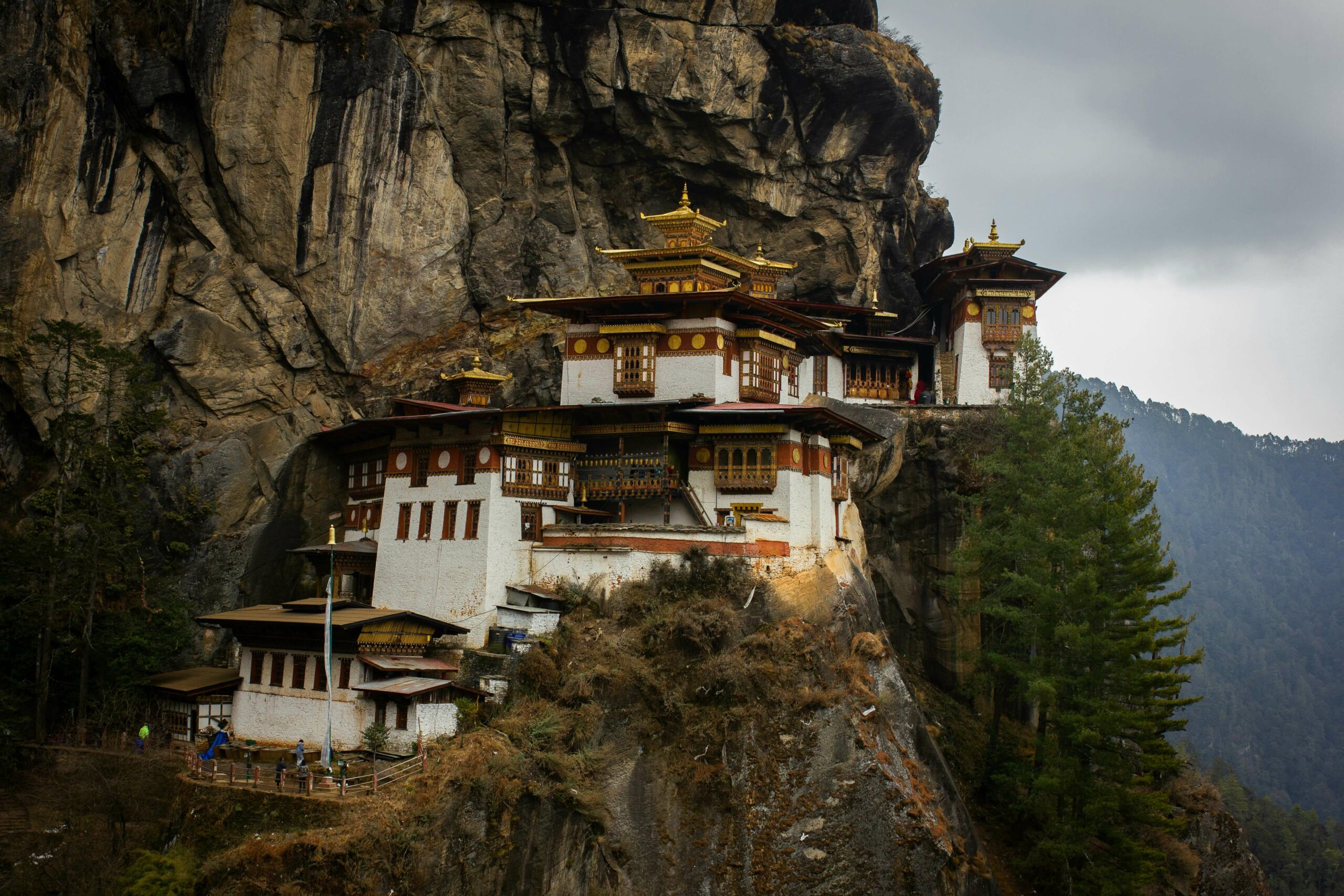
Today we set off on one of Bhutan’s most famous and sacred adventures, the hike up to Taktsang Monastery, also known as the Tiger’s Nest. Perched dramatically on a cliff high above the Paro Valley, this is where Guru Rinpoche is said to have meditated after flying in on a tigress. We follow a peaceful trail through pine forests adorned with prayer flags, reaching a viewpoint after about two hours for incredible views of the golden-roofed monastery. After a warm Bhutanese lunch, there’s the option to go even closer before heading back down. Feel free to rest in the evening and prepare for the next day’s trek.
Max Altitude
: Paro Airport (2,280 m)
Trip Duration
: 5-6 hrs
Meals
: Breakfast, Lunch, Dinner
Overnight
: Paro
Accomodation
: Hotel
Day 3: Drive from Paro to Shana (2,890m / 9,480 ft) - Distance: 15 km/ 9.3 miles, 5 hrs
The journey begins with a drive to the ruins of Drukgyel Dzong, located at the northern end of the Paro Valley. This is where the road ends and the trek begins. The view of Mount Chomolhari rising in the background offers a spectacular start.
The trail follows a dirt path for about an hour through a fertile valley, lined with forested hills and traditional farmhouses. You’ll walk alongside the Paro Chu (river), with the sun often quite strong at this elevation. The first village you’ll pass is Tsento Zampa, where you might see chillies drying on rooftops. The main crops grown here are red rice, wheat, and potatoes.
As you continue along the eastern bank of the river, the path gently leads through thick forest filled with birds and butterflies. After about two and a half hours, you’ll arrive at Gunitsawa, a military camp with a small school and shops. Your trekking permit will be checked here.
Another short walk through the woods brings you to an open meadow near the river – the Shana campsite. From here, you’ll have a stunning view of the snow-covered peak Jo Drakey.
Max Altitude
: Shana (2,890m / 9,480 ft)
Trip Duration
: 5 hrs
Meals
: Breakfast, Lunch, Dinner
Overnight
: Shana
Accomodation
: Tented Camp
Day 4: Trek to Thangthangka (3,575 m): Approx. 22 km, 7 hrs
Today’s trek is long and challenging, with both distance and altitude gain pushing the limits. After lunch, the trail becomes rough and uneven, with frequent ascents and descents.
We follow the river upstream from the campsite, passing the old Shana Bridge ruins. This bridge was destroyed in the 1950s by a massive flood triggered by a glacial lake outburst. In earlier times, it was used by travelers journeying to and from Phari in Tibet. The path gradually ascends through dense forests filled with oak, rhododendron, bamboo, and ferns. After a short walk past a small house, we arrive at a place called Shing Karap. Not far from here, we reach a junction. One route from this point leads to the now-restricted Tremo La Pass and onward to Phari, once a well-traveled trade route.
The trail then makes a brief but steep climb followed by a descent, bringing us to a large bridge at 3,250m. This is Thongo Zam, a good spot for lunch. From here, the trek continues through a beautiful forest of birch, fir, larch, maple, and blue pine. After a short uphill stretch, we reach Seyende Zam, where a large chorten (stupa) stands. If the skies are clear, we get our first glimpse of Mt. Chomolhari to the north. A final walk of about 20 to 30 minutes takes us to our campsite in a peaceful meadow.
Max Altitude
: Thangthangka (3,575 m)
Trip Duration
: 7 hrs
Meals
: Breakfast, Lunch, Dinner
Overnight
: Thangthangka
Accomodation
: Tented Camp
Day 5: Trek to Jangothang - Chomolhari Base Camp (4,044 m): Approx. 17 km, 5 hrs
After a relaxed morning with breakfast and views of Mt. Chomolhari, we begin our trek. The trail gradually rises as we leave the tree line behind and enter an open, scenic valley. Along the way, we pass Tegethang, a seasonal settlement where yak herders stay during the winter months.
The landscape opens up more as we move further into the valley. Eventually, we reach Jangothang, the base camp of Chomolhari. Surrounded by towering peaks, the area feels wide and remote. From our camp, we can see the striking peak of Jichu Drake, and nearby lie the remnants of an ancient fortress, adding to the dramatic setting.
Max Altitude
: Chomolhari Base Camp (4,044 m)
Trip Duration
: 5 hrs
Meals
: Breakfast, Lunch, Dinner
Overnight
: Chomolhari Base Camp
Accomodation
: Tented Camp
Day 6: Acclimatization Day at Jangothang- Chomolhari Base Camp (4,044 m)
Today is a rest day at Chomolhari Base Camp, giving the body time to adjust to the altitude. Even though it’s a break from moving camp, it’s important to stay active, so we’ll head out on a day hike.
One of the most rewarding walks leads eastward to the twin lakes of Tsho Phu. From the lakes, the views looking back toward Mt. Chomolhari and Jichu Drake are truly breathtaking. Keep your eyes open along the way—you might spot a herd of Himalayan Blue Sheep grazing in the valley.
Max Altitude
: Chomolhari Base Camp (4,044 m)
Meals
: Breakfast, Lunch, Dinner
Overnight
: Chomolhari Base Camp
Accomodation
: Tented Camp
Day 7: Trek to Lingshi (4,010 m): 21 km, 7 hrs
After breakfast a steep switchback trail starts climbing out of the valley into another that leads to the final climb and pass. It is a long climb about 3-4 hrs to reach the first high and very windy pass of this trek, the Nyelela Pass “sleepy pass” (4,890m). From Nyelela Pass one you can see far towards the east-northeast into the trekking area that we will be covering over the next couple of days. Mt. Takaphu dominates the view towards the north. Gangchen Ta “Tiger Mountain” is the main mountain to be seen looking east.
Less than 30 minutes down is a flat, more sheltered area, a good lunch spot. We continue to descend passing a narrow gorge with a small river crossing. The trail leads to a viewing point from which Lingshi Dzong can be seen. Our campsite is located next to a river.
Max Altitude
: Lingshi (4,010m)
Trip Duration
: 7 hrs
Meals
: Breakfast, Lunch, Dinner
Overnight
: Lingshi
Accomodation
: Tented Camp
Day 8: Trek to Chebisa: Approx. 16 km, 4 hrs
Today’s walk is considered one of the most enjoyable parts of the entire journey. We leave Lingshi with a gentle uphill climb that leads us to the charming village of Gom Yu, tucked just beneath a towering 300-meter cliff.
From there, it’s about an hour’s walk to a peaceful valley where the picturesque village of Chebisa sits, complete with a stunning waterfall at the far end. We set up camp beside the river, surrounded by the calm and beauty of this hidden gem.
Trip Duration
: 4 hrs
Meals
: Breakfast, Lunch, Dinner
Overnight
: Chebisa
Accomodation
: Tented Camp
Day 9: Trek to Shakya Pasang (4,000 m) via Gogu La Pass (4,440 m): Approx. 14 km, 5 hrs
We start the day with a steady and challenging climb up to Gogu La Pass at 4,440 meters. From the pass, the trail drops down to a stream at around 4,170 meters before we begin another long uphill stretch over a ridge.
The path then descends into the lush Jholethang valley, winding through dense forest filled with fir and birch trees. As we continue, the trail follows high above the valley floor before reaching Chachim, a high yak pasture at 4,260 meters. Our camp for the night is set beside a stream at the base of the valley—quiet and peaceful.
Max Altitude
: Gogu La Pass (4,440 m)
Trip Duration
: 5 hrs
Meals
: Breakfast, Lunch, Dinner
Overnight
: Chachim
Accomodation
: Tented Camp
Day 10: Trek to Robluthang (4,160 m): Approx. 16 km, 8 hrs
Today’s trek is a demanding one, taking us over the Jarela Pass at 4,785 meters. From the top, the panoramic views of the Himalayan peaks are truly breathtaking. After taking it all in, we make a steep descent through forested trails into the Tsarigathang valley, a remote and wild area known as the summer habitat of the rare Himalayan Takin, Bhutan’s national animal.
After crossing a stream, the path climbs again through rugged terrain until we reach our campsite at Robluthang, set at 4,160 meters.
Max Altitude
: Robluthang (4,160 m)
Trip Duration
: 8 hrs
Meals
: Breakfast, Lunch, Dinner
Overnight
: Robluthang
Accomodation
: Tented Camp
Day 11: Trek to Limithang (4,160 m): Approx. 14 km, 7 hrs
Today is one of the more challenging days of the trek, as we cross Shinche La-the highest pass on this route, at 5,000 meters (16,400 ft). The effort is well rewarded with dramatic mountain views, and if you’re lucky, you might spot Blue Sheep grazing on the high slopes or see eagles and griffon vultures soaring overhead. Yaks are also a common sight in these high-altitude areas.
The descent from the pass is steep and rocky, following a moraine down into another glacial valley. The final stretch of the trail opens up to striking views of Mt. Gangchey Ta before we arrive at our campsite, set in a quiet meadow beside a river.
Max Altitude
: Limithang (4,160 m)
Trip Duration
: 7 hrs
Meals
: Breakfast, Lunch, Dinner
Overnight
: Limithang
Accomodation
: Tented Camp
Day 12: Trek to Laya (3,800 m): Approx. 9 km, 4 hrs
Today’s walk is short and enjoyable, offering lovely views along the river, which is one of the tributaries of the Mochu. The trail leads through a damp, lush forest where moss carpets the ground and birds fill the air with their songs.
We eventually reach Laya, a unique and remote village nestled at 3,800 meters. It is the second-highest settlement in Bhutan and offers a fascinating glimpse into high-mountain life and culture.
Max Altitude
: Laya (3,800 m)
Trip Duration
: 4 hrs
Meals
: Breakfast, Lunch, Dinner
Overnight
: Laya
Accomodation
: Tented Camp
Day 13: Rest Day in Laya
Today is a well-earned rest day in the beautiful village of Laya. You’re free to relax at camp or take a stroll through the village, visiting local homes and connecting with the friendly Layap people.
The Layaps are semi-nomadic yak herders with a distinct culture and way of life. Unlike women in other parts of Bhutan, Layap women wear their hair long and dress in traditional clothing made from yak hair and sheep wool, a black skirt with brown stripes, a black jacket, and a unique pointed hat woven from bamboo.
Max Altitude
: Laya (3,800 m)
Meals
: Breakfast, Lunch, Dinner
Overnight
: Laya
Accomodation
: Tented Camp
Day 14: Trek to Koina (3,240 m): Approx. 16 km, 6 hrs
We begin the day with a descent to the army camp, then follow the trail alongside the Mo Chhu River. After crossing a bridge, the path winds up and down several times through beautiful forests of juniper and fir. After a steady walk through this peaceful landscape, we reach our campsite at Koina.
Max Altitude
: Koina (3,240 m)
Trip Duration
: 6 hrs
Meals
: Breakfast, Lunch, Dinner
Overnight
: Koina
Accomodation
: Tented Camp
Day 15: Trek to Gasa Hot Springs (2,220 m): Approx. 12 km, 6 hrs
The day begins with a steady climb up to the Balela Pass at 3,900 meters, where you’ll find a small rock cairn and a few prayer flags marking the top. After the pass, the trail starts to descend through a bamboo forest and leads to a stream. From there, it’s mostly downhill all the way to Gasa Hot Springs. If time allows, we can take a short detour to visit Gasa village and the 17th-century Dzong before continuing down to the hot springs for our campsite.
Max Altitude
: Gasa Hot Springs (2,220m)
Trip Duration
: 6 hrs
Meals
: Breakfast, Lunch, Dinner
Overnight
: Gasa Hot Springs
Accomodation
: Tented Camp
Day 16: Trek to Damji Village and Drive to Punakha: Approx. 14 km, 5 hrs
We’re a long way from the Gasa hot springs now, and the trail slowly winds its way down. We walk past terraced fields where farmers tend to their crops, through tiny villages where prayer flags flutter from rooftops, and under the shade of tall oak and pine trees. It’s a quiet, beautiful stretch of the journey, where you can really feel the heart of rural Bhutan.
Trip Duration
: 5 hrs
Meals
: Breakfast, Lunch, Dinner
Overnight
: Punakha
Accomodation
: Tented Camp
Day 17: Drive from Punakha to Thimphu, then to Paro in the Evening
We start the day with a visit to Punakha Dzong, the winter residence of Je Khenpo, the Chief Abbot, and the central monastic body. Afterward, we drive across Dochula Pass, heading toward Thimphu. Once in Thimphu, we’ll have lunch and enjoy some sightseeing before making our way to Paro in the evening.
Max Altitude
: Paro (2,280 m)
Meals
: Breakfast, Lunch, Dinner
Overnight
: Paro
Accomodation
: Hotel
Day 18: Transfer to the international airport for your final departure
After breakfast our airport representative will drop you at the Paro International Airport for your flight departure from Bhutan.
Max Altitude
: Paro Airport (2,280 m)
Meals
: Breakfast
Accomodation
: Hotel
Gallery
What is included
Accommodation
- 17 nights in a comfortable, government-approved hotels on a twin-sharing basis throughout the tour
- Tented accommodation and equipment during the camping trek (including waterproof two-person tents, dining tent, kitchen equipment, table, chairs, toilet tent, shower tent, etc.)
Meals & Drinking Water
- Breakfast, Lunch, Dinner, Tea, snacks during the trek
- Drinking water throughout the tour
Transportation
- Pick-up and drop-off at the airport and hotel using a private tourist vehicle (car, van, or minibus depending on group size)
- Private transportation and a designated driver within Bhutan with a dedicated driver in luggage vans, or light trucks
- Luggage carried by horses, mules, or yaks at higher elevations during the trek
Guide & Support Staff
- Licensed, experienced, English-speaking Bhutanese guide throughout the trip
- Required local staff and porters to carry luggage and camping gear during the trek
- Food, accommodation, salary, insurance, equipment, and medical care for all support staff
Permits & Entry Fees
- All entrance fees for monuments, museums, and cultural sites listed in the itinerary
- All access permits, trekking permits, route access permits
- All required Bhutan visa fees included
Extras & Souvenirs
- Map, duffel kit bag, and a trip completion certificate
Administrative
- Visa processing assistance for Bhutan
- 35% government royalty (part of the minimum daily package of US$200) that supports Bhutan’s free education and healthcare system
- All government taxes, official expenses, and standard tourism service charges
What is Excluded
- International flights and airport departure taxes
- Travel insurance, including coverage for emergency evacuation
- Tips for tour staff, porters, hotel staff, restaurant service, and drivers
- Personal expenses such as drinks, laundry, and other incidental costs
- Any expenses not specifically mentioned in the “Price Includes” section
Trip Departure
We book both solo and group trips to make your holiday a lifetime memory with people from all over the world. Once your trip is confirmed, we guarantee all group departure dates, even if only one person has signed up for the tour. Please note that before final sign-up, we always confirm the current number of members in your group.
Difficulty Level
The Laya Gasa Trek is challenging, with steep ascents, high altitudes, and quick changes in weather. It’s best suited for those with some trekking experience, although determined and well-prepared beginners can also complete the journey.
Dates & Prices
This journey is available on request, with no fixed departure dates. Whether you’re traveling solo, with family, or with friends, we offer private and tailor-made options designed to suit your needs. Enjoy special group discounts, the larger your group, the more you save. Choose your own travel dates, and we’ll customize the experience to match your schedule and preferences.
Meals
Most hotels in Bhutan serve a mix of Indian, Chinese, and continental dishes, with pork, chicken, beef, and fish commonly available with fresh, seasonal options. During the trek, you’ll get three meals a day with breakfast, a hot picnic lunch, and dinner at the campsite with tea and snacks. Our experienced tour cooks prepare hearty meals at altitude, and special dietary needs can be accommodated if informed in advance.
Accommodation
Hotels in Bhutan are government-rated as A, B, or C categories, roughly equal to 3- to 4-star standards. In Paro and Thimphu, we typically use A-grade hotels like Tashi Namgay Resort and Namgay Heritage, depending on availability. During the trek, accommodation will be in tents. All stays are based on twin-sharing, with a single supplement available on request for USD 378.
Weather Information
Mountain weather is famously unpredictable. Nights tend to be much colder, ranging from -2°C to -15°C, while daytime temperatures can vary between 5°C and 30°C. It’s crucial to stay warm and dry in all conditions. Be prepared for anything, as temperatures can fluctuate from -10°C to 30°C depending on the season.
Packing List
For this tour, you don’t need to bring any special equipment, just pack some comfortable clothes. However, depending on the time of year, there are a few personal items you might consider bringing. The following list is optional and based on your personal preferences.
During the tour, all heavy equipment and luggage are transported by the vehicle. However, personal items that you’ll need throughout the day, such as money, a water bottle, camera, sunscreen, and toilet paper, should be kept in your daypack. It’s advisable to pack these essentials in a smaller bag that’s easy to carry with you.
If you’re traveling to Bhutan from Kathmandu, we’ll provide a complimentary waterproof duffel bag for your use. This duffel bag is perfect for carrying your shopping items and is yours to keep after the tour. You can rent these equipment with an additional USD 35.
General
- Four-season sleeping bag (Rental available)
- Duffel Bag / Rucksack / Suitcase
- Down jacket (Rental available)
- Daypack
Upper Body
- Sun hat or cap
- Warm woolen or synthetic hat
- Balaclava
- Glacier Glasses
- Headlamp with extra batteries
- Ear Muffs (Optional)
- Neck Warmer (Optional)
Torso
- Two comfortable t-shirts
- Thermal tops- both lightweight and thicker expedition-weight versions
- A fleece jacket or pullover for warmth
- A wind-stopper fleece jacket (optional but nice to have)
- A waterproof shell jacket made of breathable fabric to protect against wind and rain
- Two sports bras (for women)- synthetic fabric is best; avoid cotton
Lower Body
- Two pairs of quick-dry nylon hiking shorts- avoid cotton
- Four pairs of underwear- again, skip cotton
- Two pairs of lightweight long underwear made of synthetic material like capilene
- One pair of soft-shell trekking pants- full side zips are ideal for convenience
- Two pairs of trekking pants, preferably the zip-off kind that can double as shorts
- One pair of hard-shell waterproof pants- Gore-Tex or similar is best. These should zip from top to bottom so you can easily put them on over boots
- One pair of casual cotton pants (like jeans or khakis) for relaxing
Tip: Keep your clothing dry by using waterproof stuff sacks or heavy-duty plastic bags
Hands
- One pair of thin liner gloves- wool or synthetic
- These work well on their own on milder days or as a layer
- One pair of warm gloves- fleece or wool is ideal
- One pair of waterproof shell gloves or mittens- Gore-Tex is recommended
- Optional: instant hand warmers can be helpful, but with the right gloves, they shouldn’t be necessary
Feet
- Four pairs of synthetic or capilene liner socks
- Three pairs of thick, warm socks for layering over the liners
- One pair of lighter socks- great for lower altitudes
- One sturdy pair of waterproof hiking or trekking boots. Make sure they fit well with layered socks and are already broken in
- One pair of lightweight shoes or sneakers for use around the lodges or in Kathmandu
- Optional: hiking gaiters- useful for keeping out dust, rocks, and moisture
- Optional: a pair of sandals for camp or teahouse use
First Aid Kits and Medications
Note: Our guides carry a basic first aid kit, but personal supplies are strongly recommended.
- Extra Strength Excedrin (for altitude-related headaches)
- Ibuprofen (for general aches and pains)
- Imodium or Pepto Bismol capsules (for upset stomach/diarrhea)
- Diamox (Acetazolamide)- consult before use
- 1 small personal first aid kit with blister treatments (moleskin, band-aids), waterproof tape, anti-infection ointments
Other Essentials
- Valid passport
- 4 Extra passport-sized photos (for permits or emergency use)
- Airline ticket (Leave a copy at the Kathmandu office in case of changes)
- Reusable water bottle or hydration bladder
- Lip balm (SPF 20+, bring 2 sticks)
- Sunscreen (SPF 40+, check expiration)
- Pocket knife or Swiss Army-style multitool
- Water purification tablets or Polar Pure crystals
- Toiletry kit (toilet paper in plastic bag, hand wipes, sanitizer, towel, soap, etc.)
- Toilet paper (2 rolls minimum)
- High-protein snacks (nuts, energy/protein bars)
- Waterproof/dry bags to protect documents and valuable
Optional
- 1 pair adjustable trekking poles (Highly recommended for knee/ankle support)
- Favorite snack foods (max 2 lbs)
- Paperback books, playing cards, mp3 player (Keep items lightweight)
- Binoculars (Optional)
- Lightweight point-and-shoot or DSLR camera (Keep batteries warm in cold conditions)
- Pee bottle or pee funnel (Useful at high altitudes or cold nights)
- Small Thermos
Tip: This list is meant as a guide. While you should try to bring the essentials, there’s room to choose gear that suits your comfort and experience. Different brands and styles offer options for everyone, go with what works best for you.
Documents and Logistics
- Valid passport (must be valid for at least 6 months beyond your return date)
- Bhutan visa clearance letter (arranged by us; required for boarding your flight to Bhutan)
- 4 passport-sized photos (for permits or emergencies)
- Travel insurance (mandatory; must include emergency medical evacuation and trip cancellation)
- Flight tickets and printed itinerary (keep physical copies for airport check-in and immigration)
- Copy of travel permit and entry documents (provided on arrival; carry with you during the tour)
Cultural Tip
Avoid wearing tight or form-fitting clothes like Lycra as outerwear, especially in rural areas. If you use them as base layers, bring something looser to wear over them to respect local customs.
Dates & Prices
We ensure departures on all published dates. If these dates don’t align with your plans, we’re happy to assist in setting a customized date. Whether you’re a solo traveler, a couple, a family, or a group seeking private trips, you can tailor-make your adventure. Reach out to us for pricing details or any other queries.
Group Discount Prices
Frequently Asked Questions
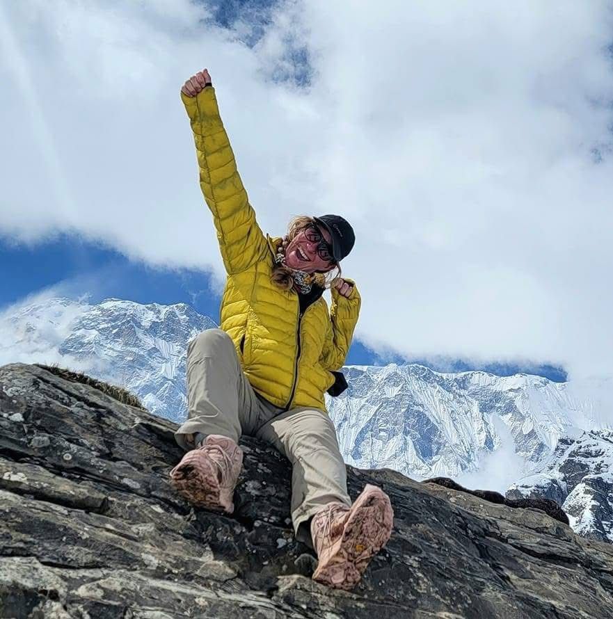
Traveler Reviews
Tripadvisor Reviews
-
 Highly recommend Goma and AMA Adventure - Highly recommend Goma from AMA Adventure. Amazing trekking guide, took us to EBC + Chola Pass + Gokyo Lakes. Honest, punctual, lovely company to have. Have trekked with... read more
 Cruiser613242
November 25, 2024 Best choice for trekking in Nepal - We were so lucky to come across Ama Adventure in a Facebook group, and specifically Goma Thapa, who's an experienced, educated, trekking powerhouse woman in charge of Ama trekking expeditions.... read more  Zofia F
December 30, 2023 Travelling to Nepal 🇳🇵 - Best of the best company ever! I have a wonderful experiences trekking to Everest Basecamp, Chola pass and Gokyo Lake with Goma. Flyer19890147734
October 22, 2023
Google Reviews

You May Also Like
USD
USD
24 Days
Moderate To Strenuous